The Great Lakes: Canada’s Freshwater Heart, From Shoreline Life to Shipping Lanes
If you live in Ontario, you don’t need a map to know where Canada’s freshwater heart beats. It thunders against basalt cliffs on Lake Superior, curls into sandy crescents on Lake Huron’s Georgian Bay, pulls steel freighters through the Seaway, and sends a million daily rhythms through Toronto’s harbour. The Great Lakes aren’t just a place on the edge of a map; they shape our weather, our infrastructure, our weekends, and in very real ways, our future. This guide explores the Great Lakes with a Canadian lens: what they are, how they work, the laws and logistics that hold them together, and the practical details for living, working, and playing along their shores.
By the end, you’ll understand the system from bedrock to breakwall. You’ll know how water levels are managed, who sets the rules for ballast water and beach safety, where to find real-time data before you launch, and how local communities are reducing algae blooms and plastic waste. We’ll also touch the long history that predates shipping canals—Indigenous governance, treaty relationships, and the stewardship work that keeps moving, wave by wave.
What Exactly Are the Great Lakes?
The Great Lakes are five massive inland seas—Superior, Michigan, Huron, Erie, and Ontario—connected by rivers and straits that eventually feed into the St. Lawrence River and out to the Atlantic. Four of the five, plus the St. Marys River, St. Clair River, Lake St. Clair, Detroit River, Niagara River, and St. Lawrence, define much of southern Ontario’s geography and economy. While Lake Michigan sits entirely in the United States, it’s hydrologically one body of water with Lake Huron (sometimes called “Huron–Michigan”), which is why water levels on those two move in lockstep.
Canada’s shoreline—mostly in Ontario—touches Lake Superior, Lake Huron (including Georgian Bay), Lake Erie, and Lake Ontario. Quebec sits on the mighty St. Lawrence corridor that carries Great Lakes water to the sea. Collectively, the basin supports over 40 million people in Canada and the United States, and provides drinking water, shipping routes, power generation, fish habitat, wetlands, beaches, and some of the country’s most cherished parks.
Key Facts at a Glance
| Lake | Surface Area (approx.) | Max Depth (approx.) | Notable Canadian Shoreline/Cities | What Stands Out |
|---|---|---|---|---|
| Superior | 82,100 km² | 406 m | Thunder Bay, Marathon, Terrace Bay, Sault Ste. Marie (ON) | Coldest, clearest, and largest by surface area; dramatic bedrock coast |
| Huron (incl. Georgian Bay) | 59,600 km² | 229 m | Sarnia, Goderich, Tobermory, Owen Sound, Parry Sound, Sudbury District | Home to Manitoulin Island—the world’s largest freshwater island—plus 30,000 Islands |
| Michigan | 57,800 km² | 281 m | No Canadian shoreline | Hydrologically continuous with Huron; levels rise and fall together |
| Erie | 25,700 km² | 64 m | Windsor, Leamington, Port Stanley, Port Dover, Pelee Island | Shallowest; warms up quickly; prone to algae blooms in the western basin |
| Ontario | 19,000 km² | 244 m | Toronto, Hamilton, Burlington, Oshawa, Kingston, Prince Edward County | Outflow to the St. Lawrence is actively regulated; deep cold mid-lake waters |
A System That Breathes
Think of the Great Lakes as one big system inhaling and exhaling. Spring snowmelt and rain lift the levels; summer heat evaporates water. Autumn storms rearrange sandbars. Winter ice changes the wave energy reaching the shore. On top of this natural rhythm sits infrastructure—dams, canals, and locks—that keeps ships moving and, in a few strategic places, helps control flows. The whole affair is cooperative by necessity: Canada and the U.S. manage this cross-border engine through treaties, data-sharing, and day-to-day operational calls by binational boards.
How the Great Lakes Formed—and Why It Still Matters
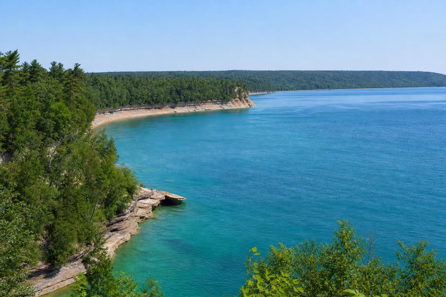
Glaciers did the heavy lifting. Over repeated ice ages, kilometre-thick ice sheets scraped bedrock basins and pushed up ridges we now call the Niagara Escarpment and the Canadian Shield’s rugged edges. When the ice retreated roughly 10,000 years ago, meltwater flooded the basins. The lakes we know today are the product of that geology plus thousands of years of shoreline adjustment. You can read the story in any cliff on the Superior shore or the limestone pavements of the Bruce Peninsula.
This origin story isn’t trivia; it drives how the Great Lakes behave. Bedrock governs how waves pound a coast. Sandy stretches like Wasaga Beach or Long Point are increasingly mobile, reshaped by storms and longshore currents. Alvars—those rare limestone flats you’ll find on Manitoulin and the Bruce—host plants you won’t see elsewhere. These are not interchangeable shorelines, and local conditions should shape local decisions about building setbacks, dune protection, and wildlife management.
Currents, Seiches, and “Mini-Tides”
There are no true tides on the Great Lakes—just a few centimetres driven by barometric pressure—but there are powerful currents and wind-driven water sloshing called seiches. A strong autumn storm can push water from one end of a lake to the other, temporarily raising levels metres in one harbour while dropping them elsewhere. That matters for mariners and paddlers; it also matters for shoreline erosion, especially when storms line up with already high seasonal water. Pay attention to marine forecasts before heading out; what looks calm in the morning can turn into a steep chop by mid-afternoon when wind aligns with fetch.
A Canadian Map of the Basin
Zoom in on Ontario and you’ll see a necklace of communities: Thunder Bay’s grain elevators facing Superior’s cold blue, Sault Ste. Marie straddling the rapids of the St. Marys River, Sarnia’s petrochemical hub on the St. Clair, Windsor tight to Detroit across the river, and the dense urban sweep around Hamilton Harbour and Toronto’s waterfront. Smaller towns like Goderich (home to underground salt mines), Midland and Parry Sound (Georgian Bay’s boatbuilding and marina culture), and coastal villages on Lake Erie add their own character. Agriculture dominates in Essex and Kent counties; orchards, vineyards, and greenhouses line much of the Lake Erie and Lake Ontario shores where the climate runs a little warmer.
Indigenous Nations have been here since long before shipping lanes and locks. Anishinaabe (including Ojibwe, Odawa, and Potawatomi), Haudenosaunee, and other First Nations, along with Métis communities, maintain deep relationships with the lakes and rivers. Modern treaties such as the Robinson–Huron and Robinson–Superior Treaties and the Williams Treaties frame Crown–Indigenous relations across parts of the basin today. Co-management and Indigenous knowledge are increasingly central to fisheries, protected areas, and restoration work—something you’ll notice in projects from Lake Superior’s north shore to the Bay of Quinte.
Water Levels: Cycles, Extremes, and What Residents Can Do
Great Lakes water levels rise and fall over seasons and decades. That’s normal. What has more attention lately is the pace and range of those swings. Warmer air can drive more evaporation in ice-free winters, while heavier downpours add water quickly. The result: it’s easier to hit new highs and new lows within a few years of each other. Communities all around the Great Lakes region have felt that whiplash—floating docks left high and dry one year; shoreline roads flooded the next.
Water levels are tracked jointly by Canadian and U.S. agencies and coordinated through the International Joint Commission (IJC) under the Boundary Waters Treaty of 1909. A few key choke points matter. The outflow from Lake Superior through the St. Marys River is managed at compensating works in Sault Ste. Marie. The Lake Ontario–St. Lawrence River system is regulated at the Moses–Saunders Power Dam at Cornwall–Massena under an IJC plan designed to balance shoreline interests, shipping, hydropower, and ecosystems. Elsewhere—Lake Huron–Michigan and Lake Erie—levels are largely set by nature. Even where we can regulate, it’s control within limits: huge lakes, modest structures.
Practical Steps for Shoreline Property Owners
If you’re living on a Great Lakes shore in Ontario, plan for variability rather than a single waterline on a blueprint. Consider:
- Setbacks and elevation: Work with your municipality and local Conservation Authority to determine safe building setbacks and elevations based on historical highs, wave runup, and erosion rates.
- Permits before you move a stone: Shoreline hardening (rock revetments, groynes) usually requires permits from your Conservation Authority and may trigger review under the federal Fisheries Act if fish habitat is affected.
- Nature-based solutions: Dune grass planting, cobble berms, and wetland restoration can absorb wave energy without pushing problems downshore the way some hard structures do.
- Insurance: Ask your insurer about overland flood coverage and sewer backup endorsements; they’re separate in many policies.
Water Quality Today: Progress, Pressure, and Your Choices
Is the water cleaner than it used to be? In many ways, yes. Since the 1972 Great Lakes Water Quality Agreement—refreshed several times—Canada and the U.S. have curbed industrial discharges, banned or restricted persistent contaminants, and invested in wastewater treatment. Several infamous pollution hotspots, called Areas of Concern, have been cleaned up or are nearing the finish line. On the Canadian side, places like Collingwood Harbour and Severn Sound were among the first to be delisted; work continues in Hamilton Harbour, the Toronto and Region waterfront, the St. Marys River, the Detroit and St. Clair Rivers, Peninsula Harbour in Marathon, Thunder Bay, the Niagara River, and the Bay of Quinte.
But the ledger isn’t all wins. Lake Erie’s western basin keeps battling harmful algal blooms fed by phosphorus from agricultural runoff and urban stormwater. Extreme rainfall can overwhelm aging sewer systems, sending combined sewer overflows into nearshore zones just when swimmers want the beach. Microplastics and “forever chemicals” (PFAS) are turning up in surface water and sediment. The work now is less about obvious smokestacks and more about a thousand small sources.
Canada–Ontario Programs You Should Know
Several frameworks guide action:
- Great Lakes Water Quality Agreement (binational): Sets broad goals and annexes on nutrients, chemicals of mutual concern, habitat, and more.
- Canada–Ontario Agreement on Great Lakes Water Quality and Ecosystem Health (COA): Aligns federal and provincial actions; renewed periodically with specific targets and funding.
- Ontario’s Great Lakes Protection Act, 2015: Enables local initiatives, targets, and protection plans, often led with municipalities and First Nations.
- Ontario’s Lake Erie Action Plan: Aims to reduce phosphorus loads in Lake Erie’s western and central basins, in line with a 40% reduction target shared with U.S. partners.
Drinking Water and Beaches: Practical Advice
Municipal drinking water in Ontario sourced from the Great Lakes is treated and tested to standards set under provincial law and overseen by the Ministry of the Environment, Conservation and Parks (MECP). Health Canada provides national guidance values, including for emerging contaminants like PFAS; a proposed national objective for total PFAS has been under development, and utilities track evolving guidance. If your home has older plumbing, consider a certified filter for lead and ask your municipality about lead service line replacement programs. Ontario lowered the drinking water guideline for lead to reflect Health Canada’s 2019 update, and many cities offer free testing for homeowners in targeted neighbourhoods.
For beaches, look up your local public health unit’s daily or weekly water quality postings during the swimming season. Blue Flag beaches signal consistently high standards, but even there, heavy rain can change the picture for a day or two. If you’re travelling, the Swim Guide maintained by community partners is a handy, plain-language way to check E. coli advisories. After storms, assume runoff may have carried bacteria to the shoreline; wait 24–48 hours before swimming, especially in urban areas or near river mouths.
Invasive Species in the Great Lakes: What’s Here and What’s at Risk
The Great Lakes basin has a long, unglamorous history with invasive species. Sea lamprey arrived through shipping canals in the 20th century and devastated native lake trout. Zebra and quagga mussels hitched rides in ballast water and carpeting sharp shells across nearshore rocks while filtering astounding volumes of water. Round goby and spiny water flea reshaped food webs. Today, managers worry about bighead and silver carp moving up from U.S. waterways, though extensive prevention work is ongoing.
What Canada Is Doing
The Great Lakes Fishery Commission (a binational body) coordinates the sea lamprey control program—an unheralded success that kept a fishery alive. On ballast water, Canada’s Ballast Water Regulations under the Canada Shipping Act require Great Lakes and Seaway vessels to manage and treat ballast to reduce the risk of new introductions, building on earlier saltwater exchange rules. Ontario’s Invasive Species Act, 2015 restricts the possession and transport of certain species, and the province has divided southern Ontario into Bait Management Zones to limit the movement of live bait, a proven vector for spreading aquatic invaders. At boat launches, you’ll increasingly see inspection and decontamination programs during peak season.
What You Can Do—Simple, Effective Steps
- Clean, Drain, Dry: Before leaving a waterbody, remove vegetation, drain livewells and bilges, and dry gear. A few minutes here can save ecosystems years of damage.
- Don’t move bait: Use locally sourced bait within the same Bait Management Zone and follow Ontario’s regulations for transport and disposal.
- Never release aquarium fish or plants: Even “harmless” species can escape and transform local habitats.
- Report sightings: Ontario’s invasive species reporting tools help managers find problems early, when they’re still have a chance to be contained.
Fisheries: Culture, Food, and Regulations You’ll Actually Use
Fishing is part weekend ritual, part economic pillar. Commercial fisheries in Ontario target species like walleye (pickerel), yellow perch, whitefish, and rainbow smelt, supporting processing in ports from Lake Erie to Georgian Bay. Recreational anglers contribute heavily to local economies—marinas, bait shops, motels, charter boats—and to community life.
Licences, Seasons, and Limits
If you’re fishing the Great Lakes in Ontario, you need a valid Outdoors Card and a fishing licence tag (sport or conservation), with exceptions for free family fishing weekends announced by the province. Seasons and catch limits vary by zone and species. Lake trout and salmon runs in Lake Ontario, walleye in the Bay of Quinte, muskellunge on the St. Clair and Georgian Bay, and steelhead in tributaries are just a few popular targets. Before you head out, check the Ontario Fishing Regulations Summary for your zone and the specific waterbody; updates happen annually and local exceptions are common.
Eat Smart: Consumption Advisories
Ontario and federal agencies publish fish consumption advisories by location and species, reflecting mercury, PCBs, and other contaminants. These advisories don’t ban eating fish—they help you choose species and sizes that are safer to eat more often. If you’re fishing with kids or pregnant family members, pay special attention to the recommended meal frequencies.
Shipping and the Great Lakes–St. Lawrence Seaway
Stand on the pier in Windsor, Hamilton, Thunder Bay, or Port Colborne and you’ll watch the continent move. Grain, iron ore, coke, steel, cement, salt, and project cargo flow in and out on lakers and oceangoing vessels. The Great Lakes–St. Lawrence Seaway system stitches it together: the Soo Locks at Sault Ste. Marie lift ships between Lake Superior and Huron; the St. Clair and Detroit Rivers run between Huron and Erie; the Welland Canal moves ships around Niagara Falls; the St. Lawrence locks take traffic downriver toward Montreal and the Atlantic.
On the Canadian side, the St. Lawrence Seaway Management Corporation oversees the Welland and Canadian Seaway locks, while the U.S. Saint Lawrence Seaway Development Corporation handles the American side. The shipping season typically runs from spring to late December, pausing while ice rebuilds and maintenance crews go to work. The Canadian Sault Ste. Marie Canal National Historic Site operates a recreational lock beside the big U.S. commercial locks—great for small craft and great for watching massive freighters slide by.
Ports, Pilots, and Careers
Ontario’s port map doubles as a crash course in the economy. Thunder Bay loads prairie grain. Goderich ships salt. Sarnia and Windsor are petrochemical and auto hubs. Hamilton handles steel and breakbulk. Toronto takes containerized cargo on a smaller scale, plus cruise ships that are once again stopping at Canadian Great Lakes ports. The Great Lakes Pilotage Authority manages pilotage on Canadian waters—another reminder that these are serious shipping lanes, not oversized cottages lakes.
Cross-Border Boating Basics
Private boaters crossing the border must report to customs. When entering Canada by water, you’ll generally report to the Canada Border Services Agency (CBSA) by telephone from a designated reporting site; when entering the United States, the CBP ROAM app is widely used. Everyone on board still needs the right travel documents. Plans and technology change, so always check current CBSA and CBP procedures before you go—don’t rely on dock talk.
Energy and Industry on the Shore
Look along the Great Lakes and you’ll see much of Ontario’s energy story. Bruce Power’s nuclear facility anchors the Lake Huron shore near Kincardine. On Lake Ontario, the Darlington and Pickering nuclear stations sit east of Toronto. Hydropower pulses through the Niagara River, including the Sir Adam Beck stations near Queenston. These facilities are strictly regulated for safety and environmental performance, with emergency planning zones, public alerting systems, and regular drills you’ve probably heard tested on a weekday afternoon.
Industrial facilities in Hamilton Harbour, Sarnia, and along the St. Clair and Detroit Rivers operate under federal and provincial rules that set discharge limits, spill reporting obligations, and environmental monitoring. Community involvement has grown; harbourfront redevelopment in places like Toronto and Hamilton layers public access and habitat restoration on top of working waterfronts. Expect more of that “both/and” approach—industry and recreation, green corridors threading through rail yards, wetlands built where slag piles once stood.
Tourism and Outdoor Adventures: Iconic Places with Local Wisdom
You can skim the surface with a sunset walk along Toronto’s shoreline, or go deep in places where the Canadian Shield tips straight into Superior’s cold, glassy blue. A few anchors for any Great Lakes travel list:
- Lake Superior’s North Shore: Pukaskwa National Park’s coastal trail, Sleeping Giant Provincial Park, and the cliffs and cobble beaches east of Thunder Bay. Even in August, Superior is cold—dress for immersion if you’re paddling.
- Bruce Peninsula and Fathom Five: Tobermory’s clear water, flowerpots, and the shipwrecks of Fathom Five National Marine Park. Crowds spike in summer; book boat tours and parking well ahead.
- Georgian Bay’s 30,000 Islands: Georgian Bay Islands National Park near Honey Harbour, Killbear and Killarney Provincial Parks, and the pink granite and white pines that inspired the Group of Seven.
- Point Pelee and Long Point: Bird migration hotspots on Lake Erie; spring and fall bring world-class birding. Long Point and the Bay of Quinte are also careworn by nutrient issues—watch local advisories.
- Prince Edward County: Wineries, beaches at Sandbanks Provincial Park, and a fast-changing coastline shaped by dunes and storms.
Cold Water, Big Fetch: Safety First
These are inland seas. A flat morning can turn to whitecaps after lunch when the wind lines up with a long fetch. Check Environment and Climate Change Canada’s (ECCC) marine forecasts and the forecasted wind gusts, not just the sunny icon. Even in late spring, water temperatures can sit in the single digits offshore; cold shock is a killer. Always wear a lifejacket or PFD, and dress for the water you’re on, not the air you’re standing in at the parking lot.
Winter on the Great Lakes
Ice brings its own joys and risks. Lake-effect snow can pile up quickly on the leeward shores of Huron and Ontario. Nearshore ice forms unevenly; currents under the ice, pressure ridges, and river mouths create thin spots that look solid from a distance. As a rule of thumb used across Canada: at least 10 cm of clear, blue ice for walking, 12 cm for a snowmobile, and 20–30 cm for small vehicles. Local conditions vary; never go on ice alone, carry ice picks, and tell someone your plan.
Coastal Communities and Real Estate: Building with Water in Mind
Buying or renovating on a Great Lakes shoreline is not the same as building on an inland pond. Erosion, wave runup, fluctuating water levels, and dynamic shorelines create a different risk profile. In Ontario, Conservation Authorities regulate development in hazard lands and along floodplains; they review shoreline projects and issue permits. Your municipality’s official plan will set additional policies and setbacks. If fish habitat could be impacted, the federal Fisheries Act applies, and serious work near the water’s edge may require review by Fisheries and Oceans Canada (DFO).
When you plan shoreline work, ask early about nature-based approaches that dissipate wave energy and maintain public values like beach access and habitat. Rock walls may feel reassuring, but they can amplify erosion for your neighbour and strip away the very beach you moved there to enjoy. A professional coastal engineer or geomorphologist familiar with the Great Lakes can save you money and headaches by designing for the site, not against it.
Indigenous Leadership and Stories on the Water
The Great Lakes carry Anishinaabe and Haudenosaunee stories as surely as they carry ships. Water walks led by Anishinaabe grandmothers, including the late Josephine Mandamin from Wikwemikong on Manitoulin Island, circled the lakes to raise awareness that “water is life”—nibi in Anishinaabemowin. Community-driven stewardship, youth canoe programs, and Guardian initiatives are restoring shorelines and cultural connections at the same time.
Co-management is also practical. First Nations fisheries authorities and community knowledge help set seasons, protect spawning beds, and monitor for invasive species. In a basin shared by two countries and hundreds of jurisdictions, governance that respects Indigenous rights and knowledge isn’t a nice-to-have; it’s the difference between fragmented efforts and durable results.
Science, Data, and Where to Check Conditions Before You Go
Real-time data has changed how Canadians use the Great Lakes. You don’t need to guess at wind and wave height before leaving the marina or beach. A few essential sources:
- ECCC Marine Forecasts: Issued for each Great Lakes marine area; include wind, waves, and special weather statements. Check for small craft warnings or gale warnings.
- Wave and Water Level Gauges: Government buoys and coastal gauges provide near-real-time readings. These help you spot seiches and understand why a harbour just went quiet or loudly piled up against the breakwall.
- Ice Bulletins and Charts: Seasonal products show freeze-up, break-up, and navigable leads—useful for both shipping watchers and winter travellers.
- IJC and partner bulletins: Monthly Great Lakes water level summaries are a clear read on where the system sits relative to averages.
On the research side, Canada’s Canada Centre for Inland Waters (CCIW) in Burlington hosts federal scientists working on contaminants, nutrients, and circulation models. Universities like Windsor’s Great Lakes Institute for Environmental Research (GLIER), McMaster, Waterloo, Western, and Lakehead contribute everything from microplastics studies to fish tagging projects you may encounter at the dock. This scientific backbone is why you can pull up credible data on your phone instead of squinting at the horizon and hoping.
Boating and Paddling: The Rules and Habits That Keep You Out of Trouble
Recreational boating on the Great Lakes feels as Canadian as a Saturday at the farmers’ market. But it runs on rules, and Transport Canada expects you to know them. Here’s what matters most for day-to-day use.
Licences, Cards, and Radios
- Pleasure Craft Operator Card (PCOC): If you operate a powered recreational boat, you need the PCOC—proof you passed a boating safety course and exam recognized in Canada. That includes small outboards and personal watercraft.
- Vessel Licence vs. Registration: Most pleasure craft with motors 10 hp (7.5 kW) or more must have a Pleasure Craft Licence number displayed on the bow. Commercial vessels and larger yachts may require registration instead.
- Marine VHF: Channel 16 is the international calling and distress frequency. To legally operate a VHF in Canada, you need the Restricted Operator Certificate (Maritime) (ROC-M) from Innovation, Science and Economic Development Canada or an accredited provider. Keep a listening watch when underway.
Required Safety Gear
Safety equipment requirements depend on boat length and type—PFDs or lifejackets of the right size for everyone on board, a sound-signalling device, watertight flashlight, bailer or manual pump, reboarding device, fire extinguisher where required, and navigation lights for night or restricted visibility. Cold water calls for extra caution: have a plan if someone ends up in 10°C water, because you will not “tough it out.”
Float Plans, Weather Windows, and Common Sense
- File a float plan: Tell someone where you’re going and when you’ll be back, especially if you’re crossing open water like the mouth of Nottawasaga Bay or the open reach to Pelee Island.
- Pick the right day: Watch for a strong wind blowing against current; on the Great Lakes, that’s a recipe for steep, closely spaced waves that turn a fine day into a slog.
- Hug the coast with care: Points, shoals, and bars stick out farther than you think. Charts aren’t optional.
- Emergency calls: Use VHF Channel 16 for distress (MAYDAY when life is at risk). The Joint Rescue Coordination Centre (JRCC) Trenton coordinates marine SAR across the Great Lakes with the Canadian Coast Guard and volunteer auxiliaries.
Paddling and Small Craft
Sea kayaks, surfskis, and stand-up paddleboards unlock a new view of the Great Lakes. Three practical notes: dress for immersion, carry a communication device in a waterproof, body-worn pouch, and plan onshore bailout points if the wind turns. Many high-profile rescues happen after offshore winds quietly blow paddlers away from a warm beach into deeper, colder water. Leashes are essential on paddleboards, but know when to use a quick-release waist leash instead of an ankle leash—moving water and strong currents can turn leashes dangerous around rocks and piers.
Beaches, Rip Currents, and Nearshore Hazards
Rips aren’t just an ocean thing. On the Great Lakes, strong onshore winds and certain beach shapes can set up rip currents that pull you away from shore. If you’re caught, don’t fight directly against the flow; swim parallel to the beach until you exit the current, then angle back in. Heed posted flags and lifeguards on patrolled beaches, and give piers and breakwalls a wide berth in waves. Rogue waves off a pier are unforgiving.
Footwear helps on rocky or zebra mussel–covered shorelines. Where water clarity is excellent, don’t let looks fool you—cliff entries on Superior plunge off in a step, and cold layers lurk just below surface warmth on Ontario and Huron in summer due to upwelling.
Wastewater, Stormwater, and the New Infrastructure We Need
Urban areas ring much of Lake Ontario and parts of Lake Erie. Heavy rain on hard surfaces runs off quickly, carrying oil, metals, nutrients, and bacteria to the nearest creek and, minutes later, the beach. Older combined sewers can overflow when stormwater and sewage share the same pipe. Cities are responding with big tunnels to store and treat combined sewer overflows and with neighbourhood-scale “green infrastructure” that lets rain soak into soil or be stored temporarily on green roofs, in bioswales, and in permeable pavements.
As a homeowner or business owner, you can help. Disconnect downspouts from combined sewers where allowed. Install rain barrels, rain gardens, or permeable driveways. On the lake, use marina pump-outs and keep bilges clean. Small actions scale up when millions of people share one watershed.
Microplastics, PFAS, and “New” Contaminants
Microplastics—tiny fragments and fibres from clothing, packaging, and tires—have been found throughout the Great Lakes. Wastewater treatment captures a lot but not all; road runoff and storm sewers are significant pathways. PFAS (per- and polyfluoroalkyl substances) show up in surface water and fish; they persist, travel, and are under active regulatory review in Canada. Municipal utilities, researchers, and regulators are responding with upgraded treatment where justified, new monitoring, and public guidance.
What can you do as a consumer? Reduce single-use plastics, install a lint filter on your dryer that captures microfibres, and support textile choices that shed less. At the community level, shoreline cleanups reduce plastic waste before it fragments. It’s not the whole answer, but it’s immediate and visible—and a gateway to the bigger policy changes that matter.
Protected Areas and Biodiversity Hotspots
The Great Lakes basin is a biodiversity mosaic. The Carolinian zone around Lake Erie holds species at the northern edge of their range—tulip trees, prothonotary warblers, eastern foxsnakes, and oak savannahs. Georgian Bay’s windswept pines and granite islands host massasauga rattlesnakes and coastal wetlands that serve as fish nurseries. Long Point and Rondeau’s marshes anchor flyways with RAMSAR-recognized wetlands. Piping plovers, once gone from many Ontario beaches, now nest again at Wasaga Beach and Sauble Beach, thanks to patient protection work.
Parks and reserves stitch this fabric together: Bruce Peninsula National Park and Fathom Five National Marine Park, Georgian Bay Islands National Park, Point Pelee, Pukaskwa, and provincial parks like Killarney, Killbear, Presqu’ile, Long Point, Neys, Sleeping Giant, and Sandbanks. Biosphere reserves—Niagara Escarpment, Georgian Bay, Long Point—overlay management that blends conservation with lived-in landscapes. If you visit during nesting or migration seasons, follow trail closures and leash rules; they’re not arbitrary.
The Blue Economy: Jobs, Innovation, and Restoration
From boatyards in Midland to research labs in Burlington, the Great Lakes power a blue economy—industries and livelihoods connected to water that range from shipping and ship repair to cleantech, fisheries, tourism, and coastal engineering. Restoration dollars seeded by federal and provincial programs create local jobs as contractors rebuild wetlands, cap contaminated sediments, and redesign shorelines. Great Lakes cruise tourism has returned after a long hiatus, adding calls at Canadian ports from Thunder Bay to Toronto and Kingston, dovetailing with waterfront revitalization.
Innovation isn’t just apps. It’s better stormwater design, ballast water treatment, antifouling coatings that don’t shed toxins, and low-wake ferry routes that protect eroding banks. It’s community science—anglers sending in fish heads for aging, paddlers logging algae blooms, students sampling microplastics on beaches—feeding into professional programs that move the needle basin-wide.
Lighthouses, Heritage, and the View from the Pier
You can learn a lot about a shoreline by the lighthouses that guard it. Chantry Island off Southampton, Cove Island at the top of the Bruce, and Point Clark on Lake Huron; Thunder Bay Main and Porphyry Point on Superior; Gibraltar Point and the harbour lights of Toronto on Ontario; and the range lights that guide freighters down tight channels. Many are protected as heritage lighthouses under federal law, and some offer tours. They’re not just postcard pretty—they’re living navigation aids, backed by Notices to Mariners and regular maintenance that keep shipping safe.
Governance 101: Who’s in Charge of What?
The short answer: many hands. The International Joint Commission (IJC) implements the Boundary Waters Treaty of 1909 and oversees water levels and quality issues on shared waters. Environment and Climate Change Canada (ECCC) leads on science and policy at the federal level; Fisheries and Oceans Canada (DFO) protects fish and habitat. Transport Canada regulates vessels and boating safety. Ontario’s MECP, Ministry of Natural Resources and Forestry (MNRF), and Conservation Authorities handle much of the day-to-day shoreland and water management. Municipalities run water and wastewater plants, beach postings, and local bylaws.
For shipping, the St. Lawrence Seaway Management Corporation and partners operate the locks and channels; the Great Lakes Pilotage Authority oversees pilots on the Canadian side. Public health units advise on beach safety. It can look like alphabet soup, but roles are clear once you trace them to the issue in front of you: fish? DFO and MNRF. Beach bacteria? Public health and the municipality. Ballast? Transport Canada and Seaway authorities. Water levels? IJC and the specific board for that outflow.
Climate Change: What to Expect and How to Prepare
Expect more variability and more extremes. Long-term ice cover is trending downward, which can boost winter evaporation and leave shores more exposed to wave action. Heavy downpours stress storm sewers and push nutrients into nearshore waters. Warm periods favour harmful algal blooms in sensitive basins like western Lake Erie. Lake-effect snow events may become more intense when cold air passes over relatively warm, open water. Adaptation is now part of everyday planning for waterfront cities, farmers, marina operators, and homeowners.
Adaptation isn’t defeatist; it’s pragmatic. Raise vulnerable electrical systems in basements, add backflow preventers, and choose flood-resilient finishes for lower levels. For marinas, floating docks and flexible anchoring help ride out a wider range of levels. Municipalities can update stormwater standards and separate combined sewers where possible. Farmers can use precision application, cover crops, and buffer strips to keep soil and phosphorus on fields and out of ditches. None of this is glamorous. All of it works.
How to Be a Good Great Lakes Neighbour
If you fish, return lead sinkers to a recycling program and switch to non-lead tackle where you can. If you boat, carry a spill kit and use bilge socks to capture oil. If you garden, go easy on fertilizers and water near the root, not the sidewalk. If you love beaches, volunteer for cleanups and speak up for dune protection when projects come to council. If you vote, ask candidates about funding for wastewater upgrades and coastal resilience. The basin’s problems are cumulative; so are the solutions.
Frequently Asked Questions
Why are the Great Lakes important to Canada?
They supply drinking water to millions, anchor major ports and industries, generate electricity, support commercial and recreational fisheries, and provide habitat for countless species. For Ontario especially, the Great Lakes basin is the economic and ecological core of the province.
Which Great Lakes border Canada?
Canada borders Lakes Superior, Huron (including Georgian Bay), Erie, and Ontario. Lake Michigan has no Canadian shoreline, though it is connected to Lake Huron and shares the same water level.
Who controls Great Lakes water levels?
Most levels are set by climate and hydrology. Outflows from Lake Superior (via the St. Marys River) and Lake Ontario (via the St. Lawrence River at the Moses–Saunders Dam) are regulated under International Joint Commission plans. Lake Huron–Michigan and Lake Erie are largely unregulated in terms of water level control.
Is it safe to swim in the Great Lakes?
Yes, when local conditions are good. Check your local public health unit’s beach advisories, especially after heavy rain, and be mindful of cold water, rip currents, and waves around piers and breakwalls. Many beaches meet Blue Flag standards.
Why does Lake Erie get algae blooms?
Phosphorus from agriculture and urban runoff fuels cyanobacteria in warm, shallow water, especially in the western basin. Canada and Ontario are working with U.S. partners toward a 40% phosphorus reduction target; farmers and cities both play key roles.
Can I drink untreated Great Lakes water if it looks clear?
No. Clear water can still contain bacteria, viruses, and parasites. Treat by boiling, filtering with an appropriate device, or using chemical disinfection; better yet, rely on properly treated municipal supplies or carry safe water.
What licences do I need to boat on the Great Lakes?
Most powered boats require the operator to hold a Pleasure Craft Operator Card. The boat may also need a Pleasure Craft Licence number. If you use a VHF radio, you need the ROC-M radio operator certificate. Carry required safety gear based on the size and type of your vessel.
How do I call for help on the water?
Use Marine VHF Channel 16 for distress. State “MAYDAY” for life-threatening emergencies, your position (GPS if possible), the nature of the emergency, and people on board. Keep transmissions brief and listen for instructions. If you only have a cellphone, call 911 and provide clear location details.
What should shoreline property owners consider before building?
Consult your local Conservation Authority and municipality for hazard mapping, setbacks, and permits. Avoid hardening the shoreline unless necessary and permitted; explore nature-based options. Consider water level variability, erosion, and wave runup in design and insurance coverage.
Are there still pollution hotspots on the Canadian Great Lakes?
Yes. Several Areas of Concern remain under active restoration, including Hamilton Harbour, Toronto and Region, Niagara River, St. Marys River, Detroit and St. Clair Rivers, Peninsula Harbour, Thunder Bay, and the Bay of Quinte. Significant progress has been made, and delistings are increasing.
What invasive species should I watch for?
Zebra and quagga mussels, round goby, spiny water flea, Eurasian watermilfoil, and Phragmites are widespread. Sea lamprey are controlled, not eradicated. Surveillance and barriers are in place to prevent Asian carps from establishing. Report new sightings to Ontario’s invasive species programs.
Can I cross the border by boat without checking in?
No. You must report to customs for both countries. In Canada, report to CBSA via designated reporting sites and procedures; in the U.S., CBP’s ROAM app is commonly used. Always confirm current requirements before you depart.
Where can I find real-time Great Lakes data?
Environment and Climate Change Canada’s marine forecasts, buoy data, and water level gauges are the go-to for Canadians. The International Joint Commission and partner agencies publish monthly water level summaries. Local harbour authorities and marinas often post conditions as well.
How cold are the Great Lakes in summer?
Nearshore temperatures can be comfortable in July and August, especially on Erie and shallow bays. Offshore, cold layers persist all summer. Upwelling events can drop temperatures dramatically overnight. Dress for immersion if you’re boating or paddling.
What’s the shipping season on the Seaway?
The Great Lakes–St. Lawrence Seaway typically opens in spring and closes in late December, with winter downtime for maintenance and because of ice. Exact dates vary by year and conditions.
Is it legal to collect beach stones or driftwood?
Rules vary. Some parks and protected areas prohibit removing natural materials. On private property, you need permission. When in doubt, leave natural features in place; they protect shorelines and provide habitat.
How can I help protect the Great Lakes from home?
Reduce plastic and chemical use, maintain your vehicle to prevent leaks, manage stormwater on your property, support local habitat projects, and advocate for infrastructure upgrades. Small actions add up in a shared watershed.
Final Thought
Stand on any Great Lakes pier and watch a freighter ease past a fisherman jogging a lure along the wall while kids chase gulls down the boardwalk. That mix—industry, nature, family time, and the quiet machinery of a working waterway—captures what’s special here. The Great Lakes aren’t pristine, and they aren’t doomed. They’re lived-in, loved, and fixable, one upstream field, one upgraded treatment plant, one restored wetland, one careful boater at a time. If you call this basin home, you have front-row seats to one of the planet’s grandest freshwater stories—and a real part to play in its next chapter.